
The Phoenix City Visitors’ map, Sharing Nature and Neighbors, is done evolving, at least for 2026. The final version is just below. You can order paper or canvas prints through the Venmo link on the order form, or just email or call in your order. I also invite you to peruse other “Place Faces” in the two-page brochure called “Imagine” at this link, for inspiration on how you might use a Place Face of your own. https://bit.ly/Place-Face
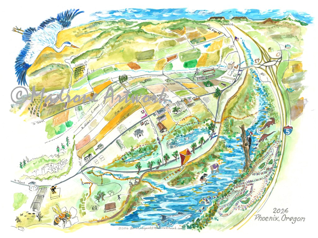

Above are close-ups of the otter and osprey sketches which you can see more developed in the “big picture” which deserves zooming in on. The colors are not final, but give more definition and placement. The skewed scale, and the small size of the original makes it impossible to get everything in, which isn’t necessary, since the goal is a concept, the “feel” of our small town.
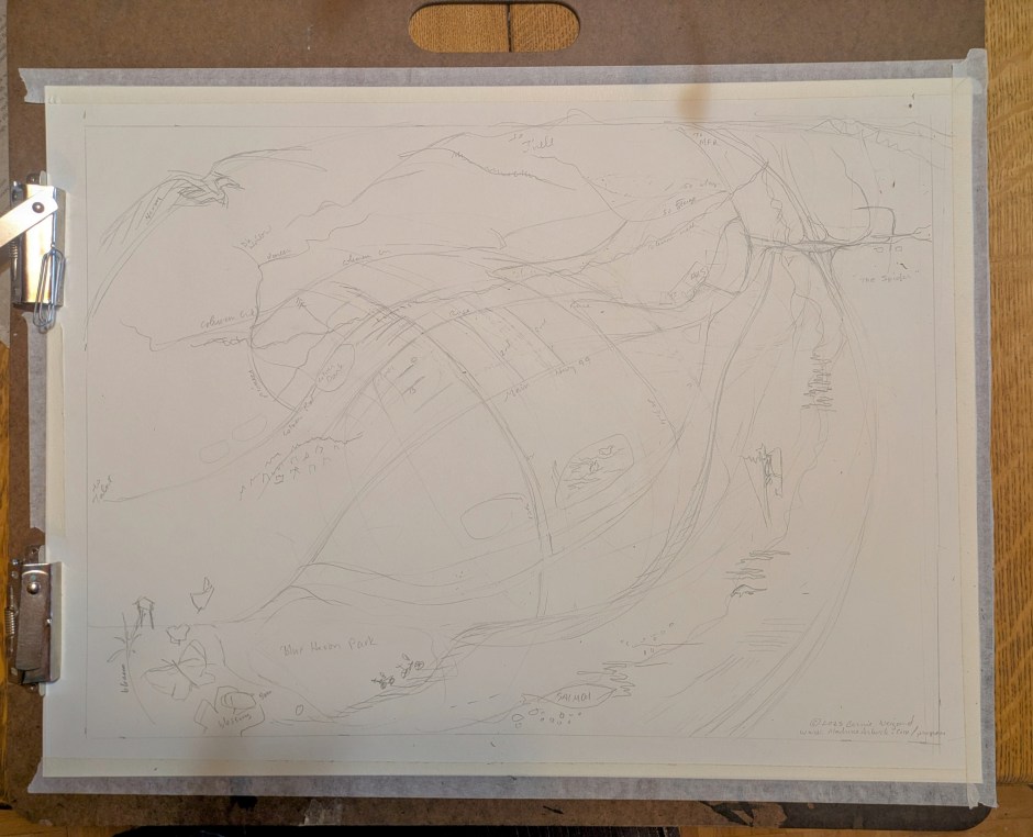
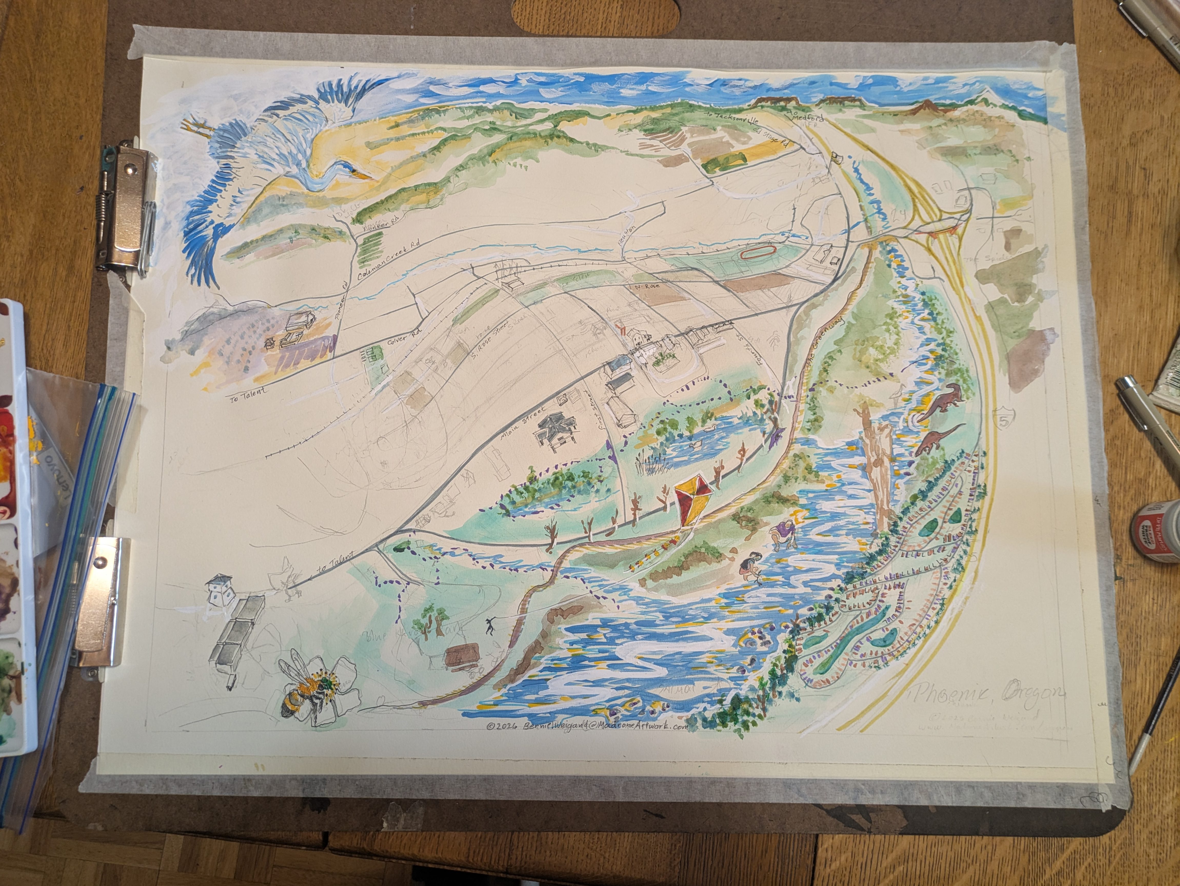
Taped tight to the 18″ x 24″drawing board, getting the streets to fit into the fish-eye/bird’s-eye was a brain-bender! It had to be done in order to make room for the many other features. A bit of refining is yet due in pencil, before the next step, some light color washes to delineate various parts. Zoom in, and do comment; it’s YOUR small town!
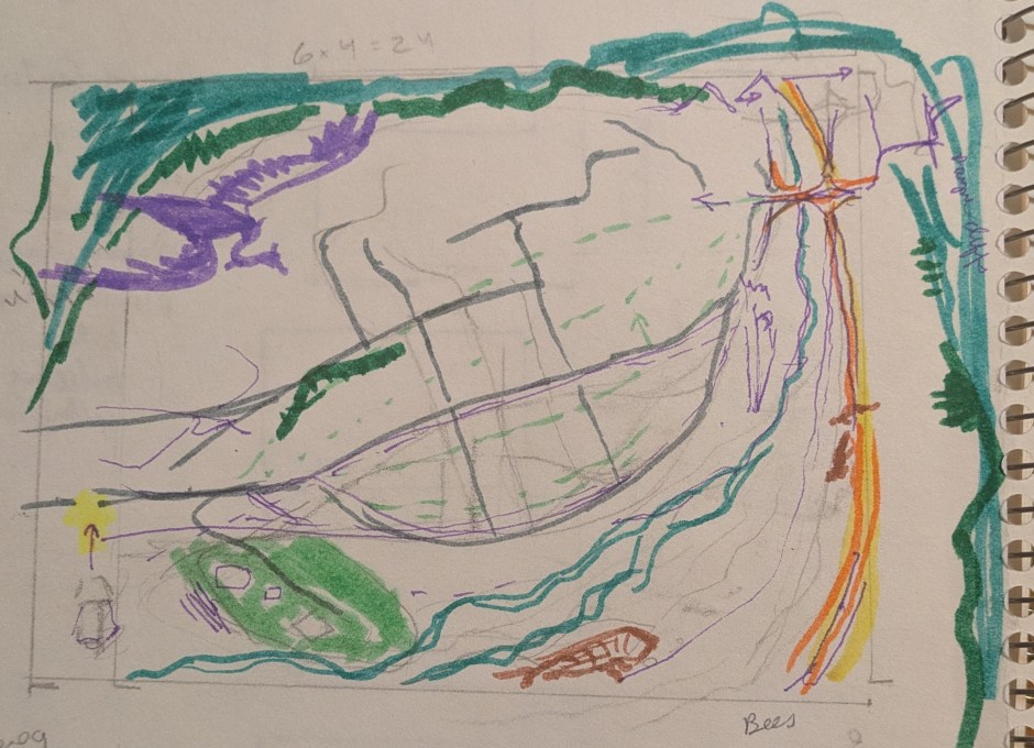
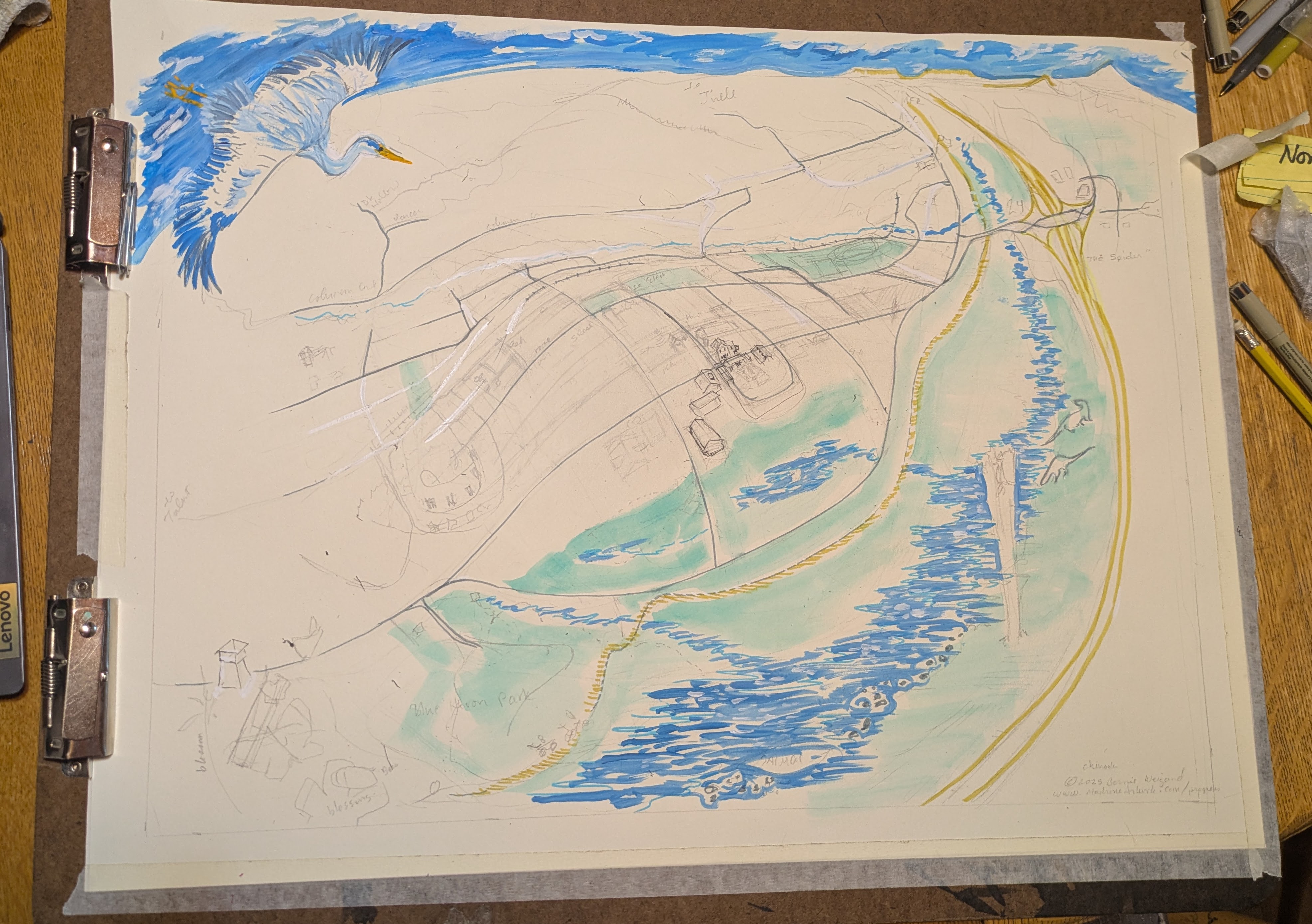
The colors in this re-worked thumbnail are just for delineating different elements of the design, not the finished color at all. It shows the approximate fish-eye distortion, and the placement of things, like the heron, otter, woodpecker, Blue Heron Park, Bandshell, Greenway, freeway, Bear Creek, true horizons, salmon, etc. It’s time for deeper research with Google Earth realities and direct observations, which will require beginning the full-size artwork. The “people doing things” can’t be shown in the too-small thumbnail sketch.
I am eager to begin on the original.
Your input is invited as the work progresses. Bernie.Weigand@MadroneArtwork.com
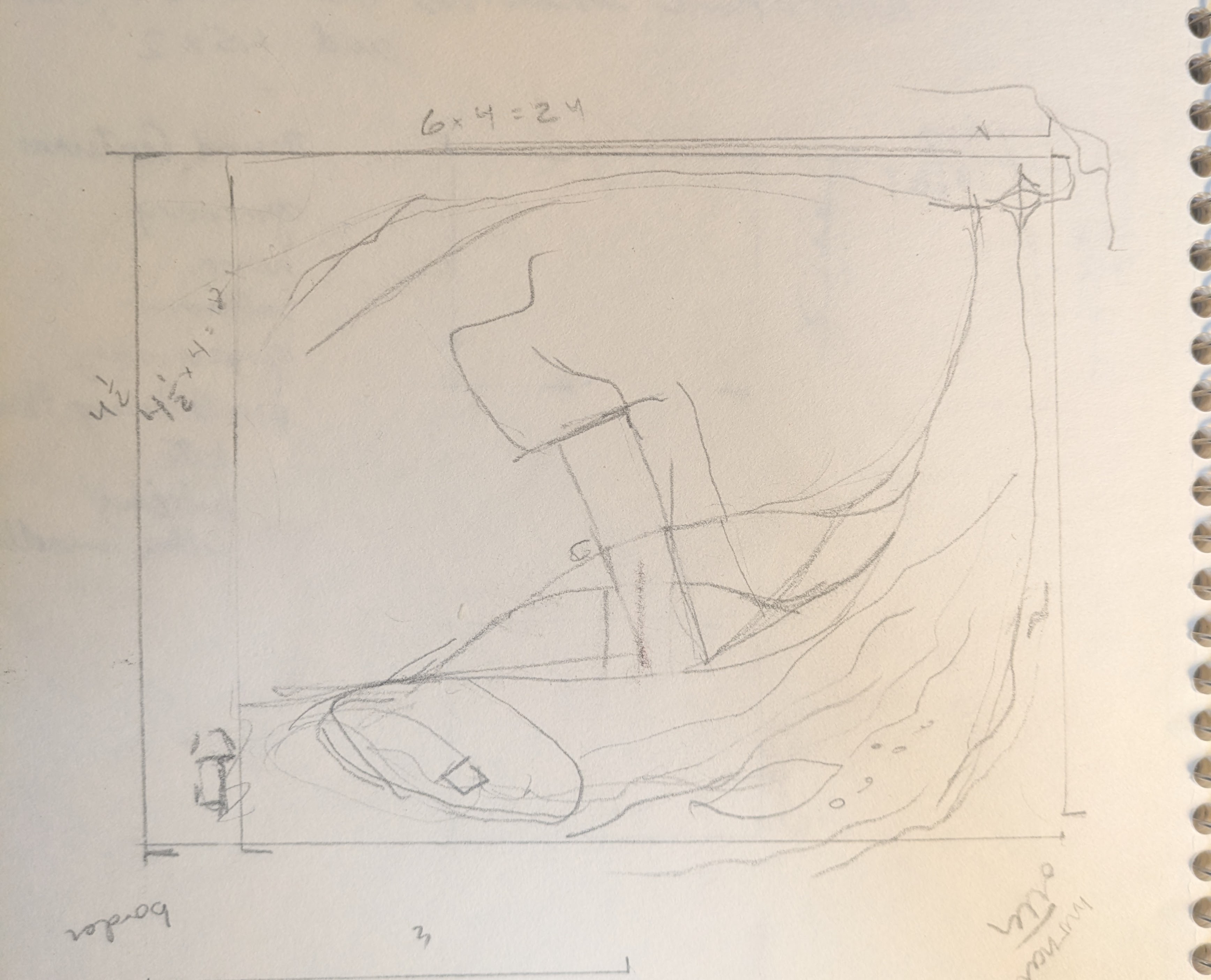
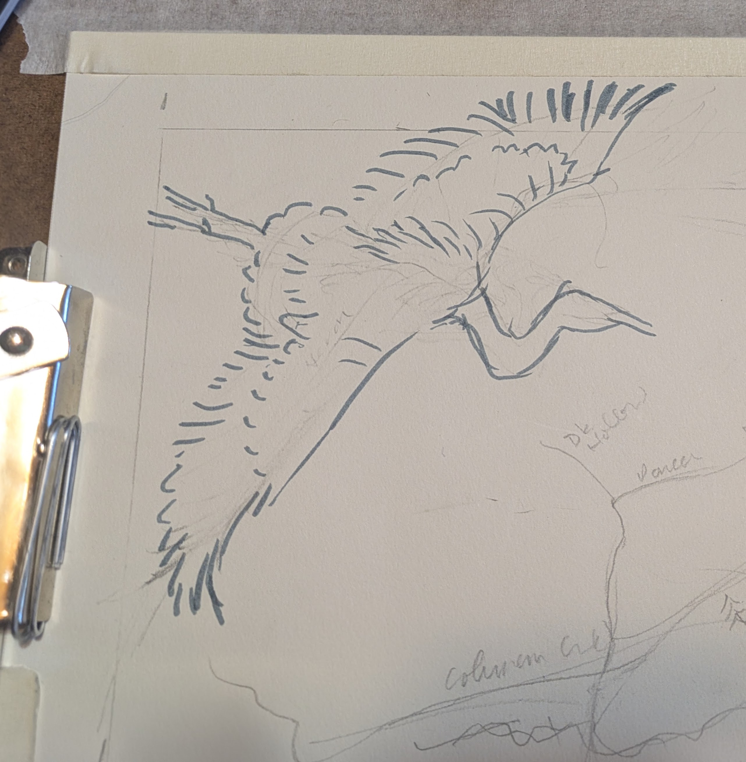
December 8, 2025 ~ As I shared this 4″ x 6″ thumbnail with my client, he added more ideas. We added an otter and a standing dead tree with habit for a pileated woodpecker. A monarch butterfly has to fit in somewhere. “The Y’s” will be the center of the “stretched” part of the fish-eye design, with other features of our very fine town fading into the distance at either end near the freeway exchange to the north and the water tower to the south. Google Earth will provide some reality to the stretched and compressed elements of the Place Face map. Now to do the math: figuring out just where the fish-eye perspective lines go.
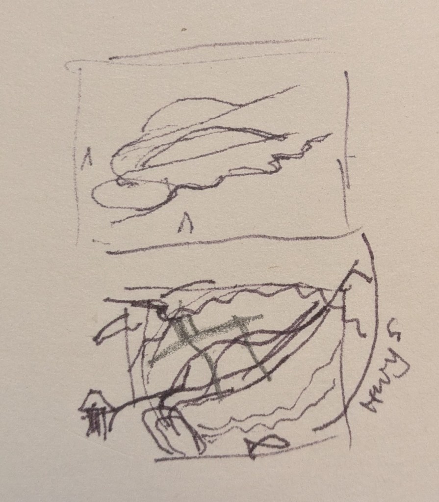
December 4th, 2025 ~ This is how it starts: rough 1.5″ x 2″ thumbnail sketches for layout and composition, a composite birds-eye and fish-eye view inside the brain. To include are the heron, salmon, people biking, walking, flying kites, Blue Heron Park and salmon – lower left, heron in flight – upper left, Bear Creek, recognizable skylines and lots of greenery, even the squiggly freeway interchange. What do you suggest? Write a comment.
